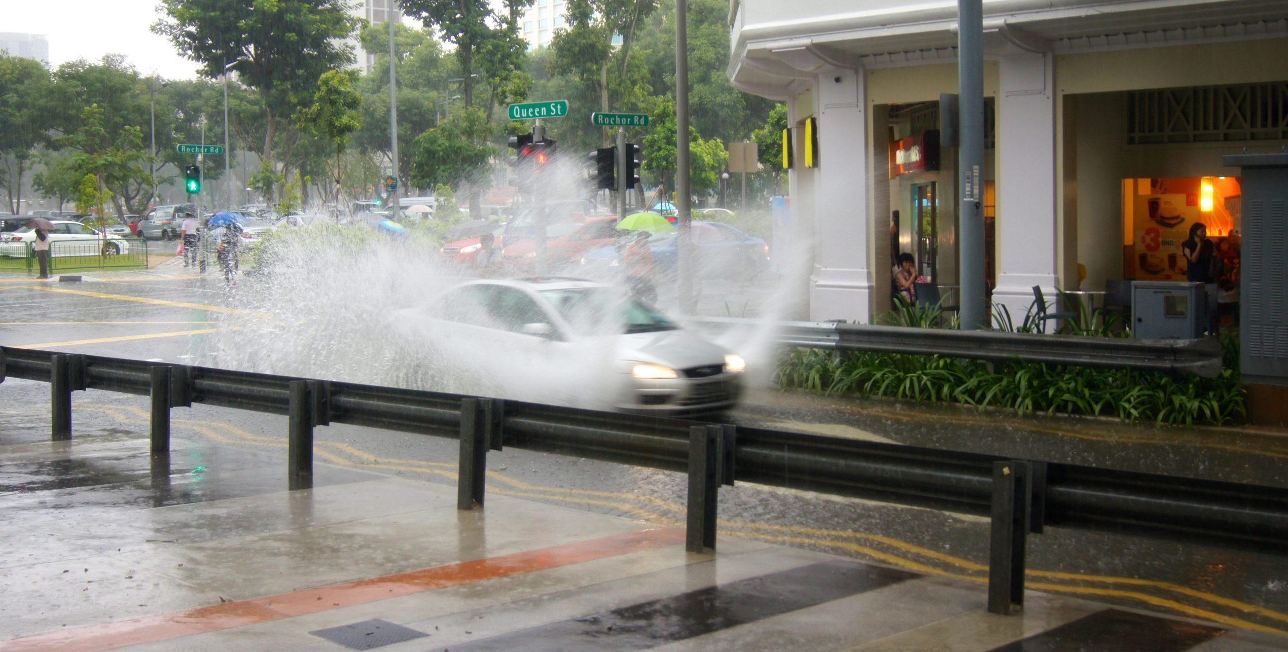
As an island, managing water is a priority for Singapore. This month, the city state stepped up its response to climate change and extreme weather events, awarding a four-year contract for a Coastal-Inland Flood Model which will be used to evaluate flood risks.
Hydroinformatics Institute (H2i) will design, build and manage the inland portion of this model. It will build on the work it has done under the NRF-supported Virtual Water for Virtual Singapore project, a 3D rendition of how water behaves in parts of the island. H2i has also separately collaborated with PUB on rainfall monitoring and prediction using X-band radar technology.
The project team includes world-renowned hydraulics specialist Professor Guus Stelling and H2i’s Senior Data Scientist Abhishek Saha.
As a visiting professor at the National University of Singapore from 2008 to 2014, Prof Stelling supervised Mr Saha’s Master’s thesis which was part of a double degree program between TUDelft and NUS. The collaboration between the two has continued over the years and has been particularly productive over past three years as they worked together on the Virtual Water for Virtual Singapore project. Prof Stelling developed a series of algorithms specifically designed for parallel hardware architectures, which will be used as a starting point for the current project. H2i will implement these algorithms on modern graphical processing units.
Why is there a need for Singapore to develop a Coastal-Inland Flood Model, and why now?
Prof Stelling: It is crucial to address water problems – extreme weather, climate change, even tsunamis – to create safe living environments. For 1,000 years, the Netherlands has been building dykes and pumps to regulate water levels. But you need the right information at the right time to decide how to act. Rotterdam’s harbour has sluice gates that take two hours to close – you need to know when to close them so the city doesn’t end up underwater. But if you close them unnecessarily, the harbour could suffer economic damage. Proper prediction systems provide timely and relevant information, so we know when and how to act.
Mr Abhishek Saha: With rising sea levels and more intense rainfall, we know there is a risk of flooding in Singapore. What we cannot pinpoint is where, when, and how that flooding will play out. In a city like Singapore, there is an especially small margin for error. Managing flood risks is a priority because Singapore is low-lying and densely built-up city that is surrounded by water. It also has a complicated landscape. A flash flood that lasts for 40 minutes in a less dense environment has very different implications in a highly urbanised city with power cables, subway systems, and a heavily utilised below-ground space. The real-time information that the model is fed now will result in better long-term insights. It allows the model to meaningfully simulate future climate and water-behaviour scenarios, especially given Singapore’s urban terrain and infrastructure, and how they uniquely affect how water flows.
Why is a parallel sub-grid system useful in the context of Singapore?
Mr Saha: “We need to strike the right balance between speed and accuracy. If you put a billion points into the model, it requires a lot of computational power and slows the model down. But if you reduce the number of data points, that reduces accuracy. The parallel sub-grid system allows you to balance the two – you take the information available on terrain and sample it meaningfully so the most useful information is extracted. My Ph.D. thesis, which is co-supervised by Prof Stelling, focuses on this in the context of parallel algorithms. With more meaningful insights, countries will know where they should be parking their mitigation dollars – and that’s really important.
Prof Stelling: Today, we are able to access a lot of very detailed data on everything from terrain to drainage. There is a question of how to optimally use all that detail for meaningful insights and to make predictions as precise as they need to be. Today, there is so much more information available, like land elevations of entire countries with 50cm by 50cm resolution. The challenge is to use all of this data in a way that is feasible on modern parallel hardware platforms.
How does water management work?
Prof Stelling: It is essentially like bookkeeping, not of financial transactions but of water budgets. We look at how much water goes in and out, as well as how things like terrain, gravity, and friction affect speed. And we try and do that as precisely as possible. Singapore has detailed elevation models so we can compute water volumes more accurately, also taking into consideration terrain and both manmade and natural drainage. Computations like this have been done for over 100 years, based on very clever simplifications to get feasible and meaningful data. Since then, hardware possibilities and data collection systems have improved beyond imagination. We live in the infotech decade, and we should be exploiting that as best we can to make living situations safer.
The impact of climate change may not be felt for a long time. Why develop a model like this now?
Mr Saha: From a flood management perspective, these models have to work in the real world and in real-time. Say there is a heavy rain warning – you want to be able to trigger this model to know which areas will have a problem, and where we need to be looking at defences. Models are also living systems – the more actual data you feed it, the more accurate they are, so they provide better long-term insights.
Prof. Stelling, you’ve had a long history with water management. How did you get into this area and what drew you to working with Singapore in 2008, and again now?
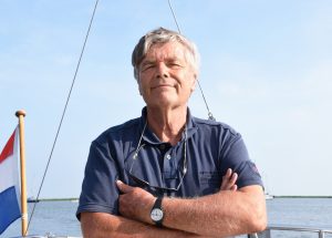
Professor Guus Stelling
Prof Stelling: I have always liked the water. I grew up in Zaandam, directly North of Amsterdam, where there is a lot of it. I am also passionate about mathematics. When you grow up in the Netherlands with a talent for mathematics but don’t want to be a schoolteacher, you find a way to combine that skill with water.
That’s how I came to study applied mathematics at TUDelft. My thesis was about using numerical algorithms to solve flow problems. After that, I moved to the agricultural university of Wageningen where I worked on interactive application systems for a DECsystem10 before moving to Delft Hydraulics to work on flow simulations. I then joined the Dutch Water Authority (Ministerie van Infrastructuur en Waterstaat) which was at the time heavily involved in managing the Delta Works, and worked on a multi-billion Euro construction project in the southwest of the Netherlands to protect a large area of land from the sea. Beyond physical protection, this included the development of advanced flow software with the US-based Rand Corporation. Eventually, I became chair professor at TUDelft.
In the meantime, I had the chance to travel the world, including as a visiting professor at the National University of Singapore from 2008 to 2014. Finding solutions to Singapore’s water challenges is especially fascinating because it is a densely built-up city with intense rainfall. You can get 10 per cent of Netherlands’ annual rainfall in a half-hour tropical storm. Today, flood protection systems rely on accurate information, generated by integrating advanced data collection systems of water and weather with simulation. Through this project, I have the exciting opportunity to be involved in the development of such a system, drawing on the latest technologies.
You’re now 72 and continue to lend your water management expertise to projects like this. Do you think you’ll ever truly retire?
Prof Stelling: I actually retired at 65, in accordance with Dutch law for public servants at that time. But I am very happy to keep contributing for as long as people find my knowledge useful. For now, neither my health nor my mind has let me down. For as long as I can continue to contribute, I will.”
Click here for more information on the Coastal-Inland Flood Model that H2i is developing.